Saturday, February 9, 2013

Jerome, Az

Thursday, Feb 7

We've settled in to Dead Horse Ranch Campground, and for the first time on this trip, we have a little extra time to catch up on some things.

This morning Bill and I took off and got the CRV washed so we could put the protective cover over the front.  We have already gotten a couple of chips in the paint, and the cover will help keep from getting more.

Jerome is literally built on the side of a mountain
Around lunch, we headed back up the mountain (we are around 3,500 feet elevation at the park and Jerome is around 5,300) to revisit Jerome.  Bill didn't get to see it yesterday - all he saw was the yellow line going down the center of the highway.

We had a nice lunch at an open air restaurant - Grapes, the girls did some shopping, and Bill and I enjoyed the bars.
Lunch at Grapes in Jerome
We came back to the motorhome and then Bill and I took off to Tuzigoot National Monument.  I had not heard of this until we got here, but we found it to be very interesting.


For Evan and Anna:  Tuzigoot (Apache for "crooked water") is the remnant of a Southern Sinagua village built between 1125 and 1400.  It crowns the summit of a long ridge that rises 120 feet above the Verde Valley and river.

Pueblo ruins

Tuzigoot as seen from out campground
The original pueblo was two stories high in places, with 77 ground-floor rooms.  There were few exterior doors; entry was by way of ladders through openings in the roofs.

The village began as a small cluster of rooms inhabited by about 50 persons for 100 years.  In the 1200s the population doubled and then coupled again as refugee farmers, fleeing from drought in outlying areas, settled here.

Thursday, February 7, 2013

Cottonwood, Az

Wed, Feb 6

When we have a choice, we always take the back roads rather than driving on the Interstate Highways.  When on the Interstate, we only drive 60 mph because of the limitations on towing the CRV, and at that speed, the large trucks fly by us and their wind stream makes the RV weave, which can be uncomfortable.  The other reason is that the Interstate highways out here (and most everywhere) have been torn up by so much large truck traffic.

So this morning, we found a good route to the Cottonwood/Sedona area that took us on some good 2 lane highways.

We had noticed that there were some "squiggles" on the map, but didn't pay much attention to them.

About half way, Bill took over the driving (before the squiggles).  Well, Bill got to experience some real mountain driving.  The Historic Jerome Clarkdale Cottonwood highway across Mingus Mountains  ranks right up there with the Million Dollar Highway and Trail Ridge Road in Colorado.

According to the tee shirt we've bought Bill, it has 158 curves in 12 miles.

Now Bill is an experienced RV driver with a trial by fire.


On the descent, we drove through the town of Jerome.

The main street, which is the highway through town has some very narrow sections that seemed to reach out to the RV.


The scenery is beautiful.
Definitely turn left here
We have settled into the Dead Horse Ranch State Park Campground, with beautiful views of the mountains.


Wednesday, February 6, 2013

Grand Canyon

Monday, Feb 4

The temperature every night since we arrived in New Mexico has been below freezing, as low as 13 and this morning around 27.  Every night we remove the water hose so it doesn't freeze solid, which makes putting it in the storage compartment a little difficult.  The cold temperatures also means that the propane furnace runs most of the night - there's not much insulation in a motor home.

We left OK RV Park heading West.  We've been on a steady Westward course since leaving Asheville.  When we leave here (Grand Canyon), we'll finally be heading South.

We arrived at the Grand Canyon early enough to spend a couple hours walking the trails overlooking the canyon.  It is truly spectacular, but it's so massive it's hard to take it in.  We've compared it to the Black Canyon of the Gunnison in Western Colorado, which we visited a couple years ago.  In many ways, the Black Canyon was more impressive because it was so narrow and so  deep.  However, the Grand Canyon is indeed "Grand".  And picturesque.


The ladies show off their new socks, which they purchased yesterday - and found out today are made in Vermont.

For Evan and Anna:  The Grand Canyon tells a story of geologic processes played out over unimaginable time spans.  It is a unique combination of size, color, and dazzling erosional forms:  277 river miles long, up to 18 miles wide and a mile deep.  The rugged landscape hosts a fascinating variety of plant and animal communities, from the desert next to the Colorado River deep in the canyon to montane forest atop it North Rim.

Humans have played parts in the story of thousands of years.  Broken spear points, enigmatic split-twig figurines, decorated pots, abandoned mines, and historic hotels suggest some who have called the canyon home.

We are on the South Rim of the canyon, which is about 1,000 feet lower than the North Rim.  The
The South Rim and North Rim are just 10 miles apart as a raven flies, but 215 miles by road.  The South Rim elevation is 7,000 feet with temperatures in the 50s - 80s in summer and the 20s - 50s in winter.  The North Rim, 1,000 feet higher, is about 10 degrees cooler than the South Rim.

Tuesday, Feb 5

I suffer from the same inadequacies as many other much better writers when it comes to describing the Grand Canyon.  In our 2 days here, I've read many attempts to describe it and they all seem inadequate.  About the best I've seen is "You have to see it to believe it!'  It is overwhelming.  It is so vast that it is  difficult to get perspective when looking at it.  It seems that the best pictures have a tree in the foreground in an attempt to provide perspective.

Today, we took Hermit's Rest Road West of the main series of complexes (the main complex consists of hundreds of staff residences, hotel rooms and camping facilities - over 1,700 places to stay).  This road is only open to private vehicles in the winter.  In the summer, only tour buses are allowed because it is so popular - and beautiful.  We stopped at about every overlook and walked some short trails.  I think we took about 150 pictures - but none are adequate.

Late in the afternoon we went to an IMAX theater and thoroughly enjoyed a movie about the Grand Canyon.

Imagine what the first explorer riding in on horseback said when he first saw the canyon.  As he rides across the flat desert, all of a sudden he comes upon the sheer cliffs overlooking the canyon.  The first thing out of his mouth is a command to the horse.  Whoa!!

This is the best time of year to visit the park.  The crowds are sparse and all the facilities are open. I read that as many as 23,000 people a day come here in the summer.  I can't imagine that it's much fun with so many people here.

Our evenings are filled with Downton Abbey.  We have the first two seasons on DVD and we've ordered the third to meet us in Tucson.


IPADs are very popular.  With all the gadgets, we have 4 GPS systems .


Four friends enjoying a spectacular setting together


Elk roam the area.  This male was herding his group of 12 females.

The elk are traffic stoppers.  

The Grand Canyon is 215 miles long

Late afternoon is the best time for taking pictures as the shadows define the view.


Sunday, February 3, 2013

Leaving Albuquerque and Petrified National Park

Saturday, February 2

Finally, we're on the way!

This morning, we have a lot of loose ends to finish up.  A trip to the Base Exchange and Commissary and getting some things to finish up the tow system and we finally head West.

We can't drive over 65 mph because of limitations on towing speed for the CRV.  But it's a nice drive toward Arizona.


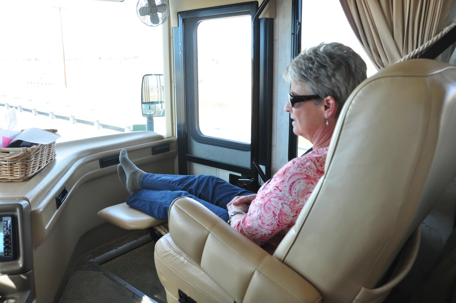
Jan enjoys the recliner

The Main Driver


Our first destination is the Petrified Forest National Park and Painted Desert, about a 4-5 hour drive from Albuquerque (which is about all we want to drive in a day).

We had visited this last year and really enjoyed it.  It is definitely worth another visit.

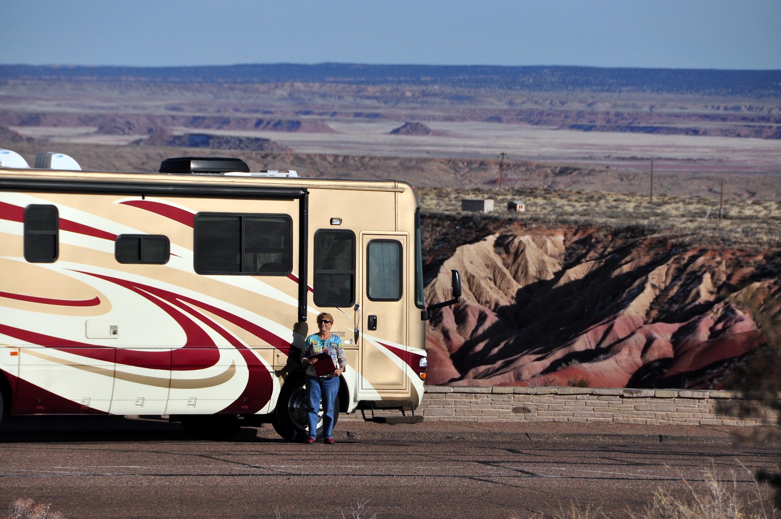
We arrive around 3 PM and decide we can't really enjoy all that the park has to offer in 2 hours, so decide we'll stay in a campground about 15 miles West in Holbrook, Az and come back tomorrow.  Today, we ride a short distance in the Painted Desert and enjoy a beautiful afternoon.
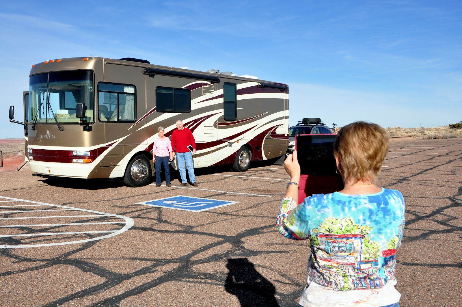
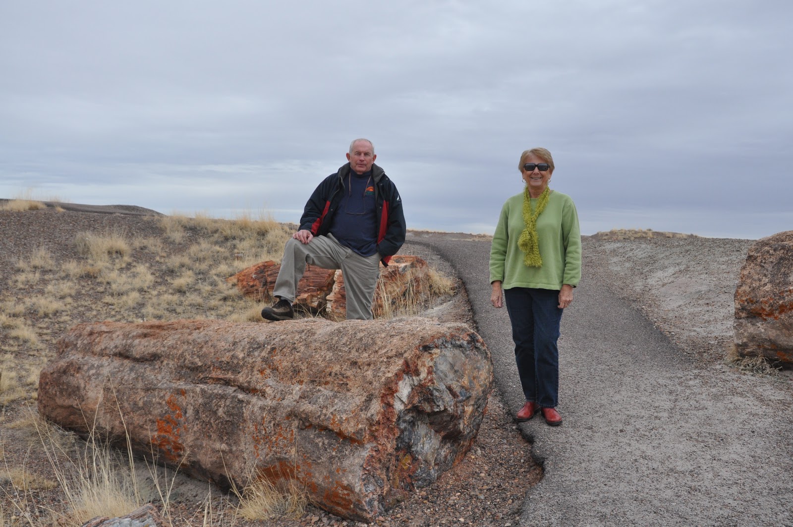
Clara taking a picture of Bill and Jan


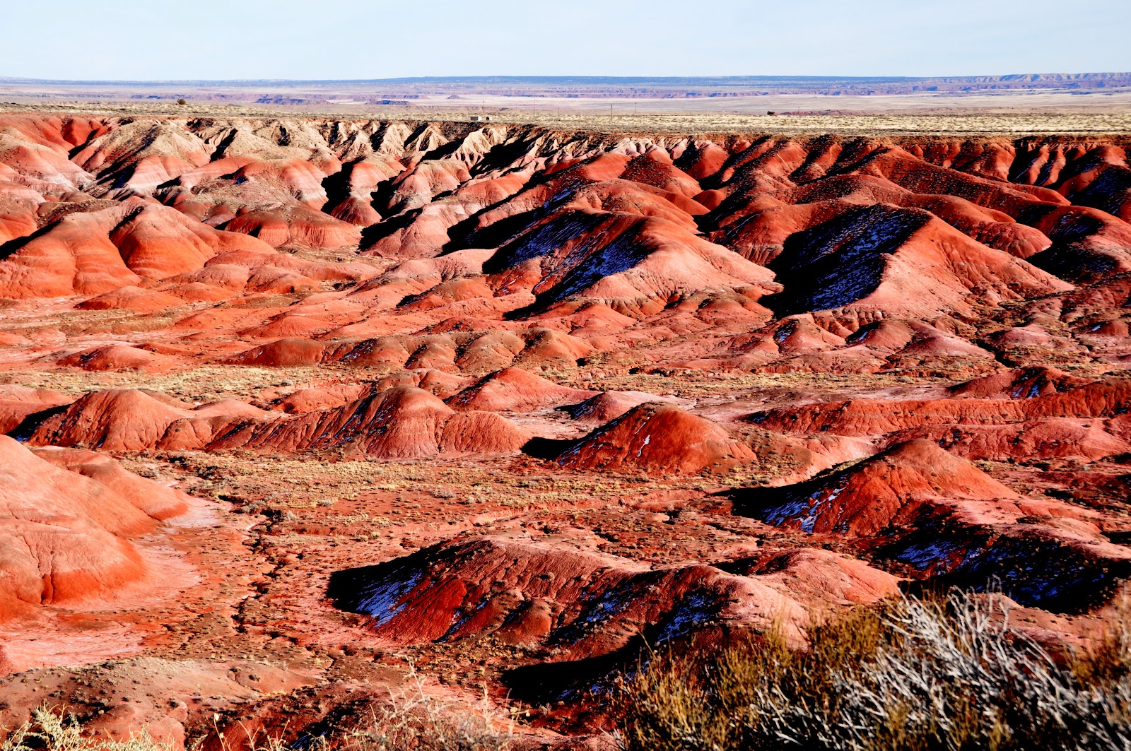
There's a reason it's called the Painted Desert

The two ladies!!


Then head further West to OK RV Park on Historic Route 66.  We'll leave the motorhome at the RV park tomorrow and take the TOAD back to the park.

We are finally on the way!  Right now our destination is Tucson.  Maybe we'll make it sometime in the next week or so.  We still have hopes to make it to the Grand Canyon.


Sunday, Feb 3

This morning we woke to overcast skies at OK RV Park in Holbrook, Az after a peaceful, quiet night.  We unhooked the CRV and headed toward the South entrance to the Petrified Forest National Park.

After an interesting stop at one of the several places that sell Petrified Wood (which is collected from areas outside the National Park) and purchasing a nice sandstone rock for the Mountain House, we headed into the Park.  The sandstone rock was formed as layers of dirt and silt were deposited and have many beautiful formations.  The one we choose looks like mountain layers.

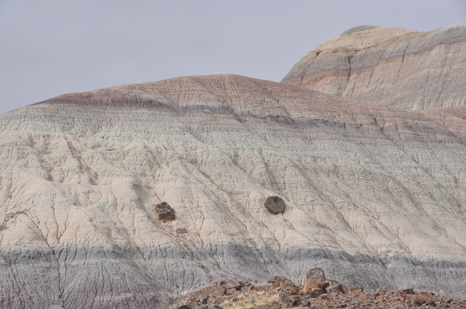
We took a very slow drive to the North entrance (where we had been the day before).  We tried to stop at just about every overlook and point of interest.

Petrified wood log

This log was buried under sometimes hundreds of feet of silt in river beds 225 million years ago. As the continent was formed, these river beds were raised to their current levels 5,000 feet above sea level.  Today, erosion is slowly uncovering these logs.

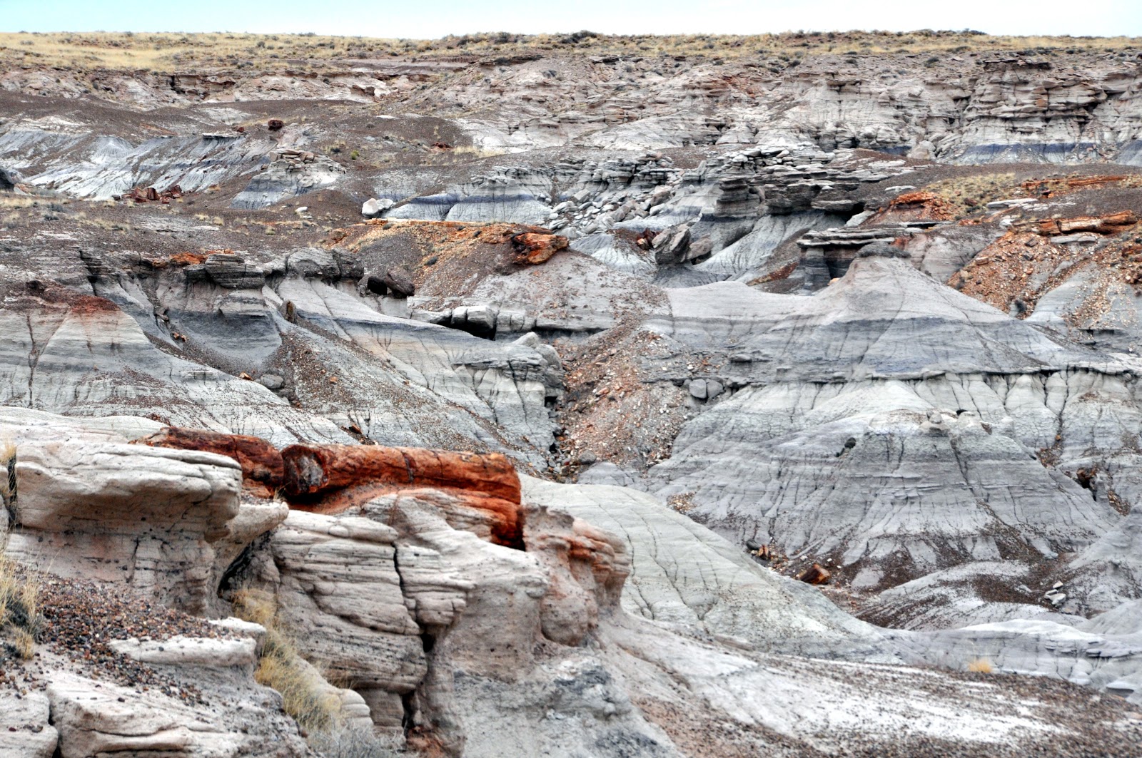
The erosive forces of nature are clearly visible.


For Anna and Evan:

The Petrified National Forest is a high, dry grassland that was once a vast floodplain crossed by many streams.  Tall, stately conifer trees grew along the banks.  Crocodile-like reptiles , giant amphibians, and small dinosaurs lived among a variety of ferns, cycads and other plants and animals known only as fossils today.

The trees fell and swollen streams washed them into adjacent floodplains.  A mix of silt, mud and volcanic ash buried the logs.  This sediment cut off oxygen and slowed the logs decay.  Silica-laden groundwater seeped through the logs and replaced the original wood tissues with silica deposits.  Eventually the silica crystallized into quartz and the logs were preserved as petrified wood.

Over the 225 million years since the trees lived, the continents moved to their present positions, and  this region was uplifted.  As a result the climate changed, and the tropical environment became today's grassland.

Over time, wind and water wore away the rock layers and exposed fossilized ancient plants and animals.  The hills will yield more fossils as weather sculpts the Painted Desert's soft sedimentary rock.

In the mid-1880's U. S Government mappers and surveyors exploring this area carried stories back East of the remarkable "Painted Desert and its tress turned to stone".

In 1906 President Theodore Roosevelt set aside selected stands of the petrified trees and the Petrified Forest National Monument..  In 1962 Congress designated the monument as a National Park.